NORTHERN OREGON COAST: Lewis & Clark Meet the Pacific
Story & Images by Vicki Andersen
HighOnAdventure.com JUNE 1, 2009 |
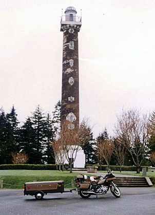 |
I have gasped my way up 164 stairs (but who’s counting?), and it was definitely worth it. At the top of the Astoria Column on Coxcomb Hill, I am at the highest point in the very northwestern tip of Oregon, and the view is simply astounding: forests, mountains and water - lots of water because this is where the Columbia River empties into the Pacific Ocean. The recorded history of this region dates to 1792, when American Captain Robert Gray sailed his ship, The Columbia, across the bar and into the muddy waters of the mighty river that he named for his ship. His brief encounter with this waterway provided the United States with a strong claim to the Oregon Territory.
|
 |
Astoria Column Vicki Andersen photo |
|
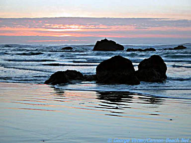
Pacific Ocean George Vetter photo |
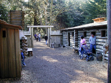
| A few years later the Astoria area became the western terminus of the Lewis and Clark Trail, when the Corps of Discovery spent the winter of 1805-06 encamped at nearby Fort Clatsop and caught their first glimpse of the Pacific Ocean. The explorers were glad for the chance to restock provisions, sew new clothing and moccasins and bring journals up to date, but weren’t impressed with the weather: It rained all but 12 days of their nearly four-month sojourn. |
| |
 |
|
 |
|
| |
Fort Clatsop Astoria-Warrenton Area Chamber of Commerce photo |
|
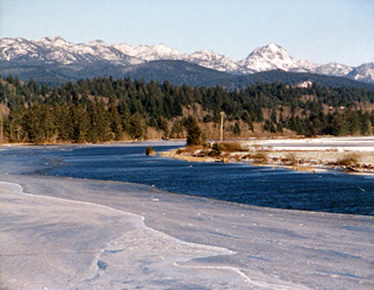
Snowfall along Nestucca River Vicki Andersen photo |
|
The climate must not have dampened the Corps’ optimism about the region. When their report reached New York financier John Jacob Astor, he dispatched a group of fur traders to establish a trading post, which would become Fort Astoria. This put Astoria into the record books as the oldest American settlement west of the Rockies. The boom of logging, fishing and shipping drew so many settlers, soon the town could boast of having the first post office west of the Rockies and the first U.S. Customs House. By the end of the 19th Century, Astoria had blossomed into the most spirited boomtown between Seattle and San Francisco.
Before reaching the Column, I wandered up and down the streets that are etched into Coxcomb Hill: streets lined with Victorian homes resplendent in dazzling colors and fanciful adornments. These beautifully-preserved structures help justify the town’s nickname, “The Little San Francisco of the Pacific Northwest.” About 75 of these buildings and other sites around town are listed on the Register of Historic Places. The Astoria Column, patterned after Trajan’s Column in Rome, contains 14 murals spiraling 125 feet skyward in a glorious depiction of Oregon’s early history. |
 |
|
 |
Astoria’s Waterfront Astoria-Warrenton Chamber of Commerce photo |
|
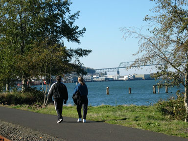
Astoria’s Riverwalk Roger Warren photo |
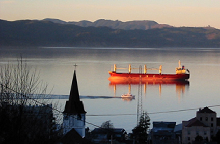
The Columbia River shipping lane draws near shore on Astoria's waterfront where the Riverwalk has great places for close-up views of the water traffic. River history is told through interpretive displays at the 14th Street Pier, while radio speakers transmit live conversations between ship pilots and the Coast Guard.
The Columbia River Bar is infamous as the most treacherous in the world, having caused more than 200 major shipwrecks and claimed over 2,000 vessels of all types. The Columbia River Maritime Museum chronicles the river’s activity, from dugout canoes navigating these waters, through sailing ships, to modern times. It houses one of the largest collections of nautical artifacts on the West Coast, as well as interactive displays and hands-on exhibits. |
Astoria Bridge Astoria-Warrenton Area Chamber of Commerce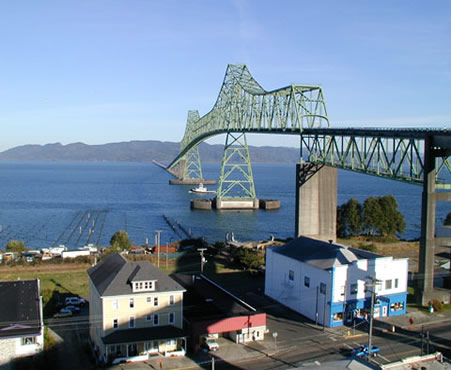 |
The Astoria-Megler Bridge is a picturesque photo-op that connects Astoria and Point Ellice, Washington. This 4.1-mile bridge is the longest three-span truss bridge in the world. Because pacific storms can produce extremely high winds, it was built to withstand gusts of up to 150 mph. The piers are designed to hold up if massive floodwaters conveying entire trees slam into them. Dedicated in 1966, this was the final piece of the Canada-to-Mexico highway system.
The flat land of the downtown area didn’t exist 150 years ago. Back then, the hills marched right down to the shoreline and the original businesses were constructed on pilings over the water. In less than three hours in 1922, a fire reduced 30 blocks and more than 200 business establishments to ashes. Dockside oil tanks barely escaped the inferno. During reconstruction, the land was filled in and the buildings set on concrete. But visitors during the winter of 1805-06 found no businesses
from which to restock their provisions,
and salt was a necessity for preservation of meat.
Five of their group trudged 15 miles south to the area now known as Seaside, where they established a salt production camp. Five kettles boiled 24 hours a day, and in two months they were rewarded with 3.5 bushels of “Excellent, fine, strong and white” salt.
|
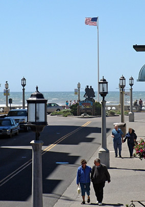
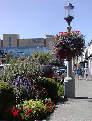
| The Clatsop Indians had made their home here for thousands of years, and this wasn’t their first encounter with white men. Shipwreck survivors, traders and trappers had come this way. It would be less than fifty years after Lewis & Clark’s visit that the first guest house opened. Once an aging oceanside resort town, Seaside has spruced up and reinvented herself. There are still a few trinket shops and caramel corn-taffy stands along Broadway, the town’s main tourist drag, but the feeling is less “Coney Island” with upscale shops and art galleries, cherry landscaping and attractive pedestrian walks. |
| |
 |
|
 |
|
| |
Seaside's Broadway StreetSeaside Chamber & Visitors Bureau photo
|
|
Seaside Landscaping Seaside Chamber & Visitors Bureau photo |
|
|
|
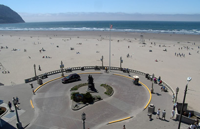
| Besides strolling the three miles of beach and window shopping, there are many other activities to enjoy. The Aquarium, oldest on the West Coast, enjoys an ocean-front view, and kids of all ages love to feed their seals. The Lewis & Clark Salt Cairn commemorates where expedition members produced their priceless and necessary commodity. The Turnaround, where Broadway street meets the beach, is designated the official end of the Lewis & Clark Trail, with a bronze statue of the two adventurers. |
 |
|
 |
| Seaside Turnaround Seaside Chamber & Visitors Bureau photo |
|
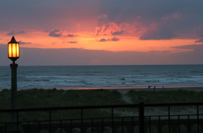
Sunset at Seaside Vicki Andersen |
In January 1806, William Clark lead a small party south to trade for blubber and oil. His weary but exhilarated party, which included the Shoshone Indian Sacagawea, crested Tillamook Head and Clark wrote in his journal: “We arived on a butifull Sand Shore” (sic). On the beach below was the 105-foot skeleton of a whale, stripped clean by Native Americans who were now engaged in extracting oil from the blubber. This was Clark’s first impression of what would eventually become Cannon Beach. It would take a shipwreck, however, to give the town its name.
For years the area was known as Elk Creek because of the large herds that roamed the region. In 1846, a cannon from the U.S. Navy ship “Shark”, which shipwrecked just inside the mouth of the Columbia River at Astoria, washed ashore about seven miles south of Seaside. Replicas of this armament greet visitors at both entrances to the hamlet of Cannon Beach, while the original cannon is on display at the Cannon Beach Historical Society. |
 |
|
 |
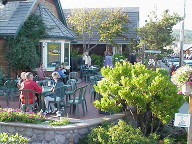
Cannon Beach Landscaping George Vetter photo |
|
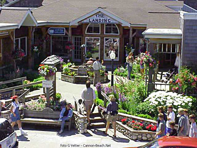
Cannon Beach Shops George Vetter photo |
| Now the former blubber extraction locale has metamorphosed into a tasteful enclave of shops, galleries and eating establishments. Most are situated along Hemlock Street, the main thoroughfare, and the entire scene is dotted with colorful and alluring landscaping. Artists and craft persons have made their home in this “Laguna Beach of the North” for decades. |
 |
|
 |
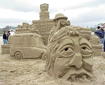
Sand Castle Contest 2002 Winner 'Lost Mayan Way' George Vetter photo |
|
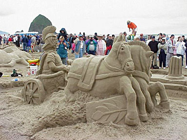
Sand Castle Contest George Vetter photo |
| Seven miles of beach beckon with promises of kite flying, picnicking, horseback riding, or enjoying the crackle of a beach fire while watching a colorful sunset over the ocean. Guide your kayak through a cresting wave, canoe up Ecola creek, or grab your surfboard and test the breakers. Kite and sandcastle festivals celebrate the natural endowments of the area. From mid-December to early February, it’s common to see gray whales migrating south to give birth in the warm waters of Baja California, returning north in early to mid-spring. |
 |
|
 |
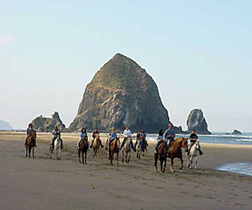
Haystack Rock George Vetter photo |
|
Tide Pool Anemones George Vetter photo |
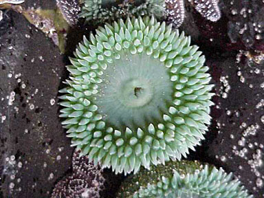
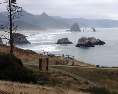
The beach is dominated by Haystack Rock, 235 feet high and one of the world’s most photographed off-shore monoliths. The world’s third largest offshore monolith, this intertidal sea stack is home to rookeries for four species of birds. Denizens of its tide pools include anemones, nudibranches, crabs, sponges, mussels, barnacles, limpets, snails and sea stars. Protected as a National Wildlife Refuge and Marine Garden, you cannot collect plants or animals, nor disturb nesting birds.
|
 |
|
 |
Lush Forest Surrounds Cannon Beach George Vetter photo |
|
Ecola State Park Vicki Andersen photo |
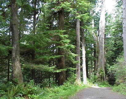
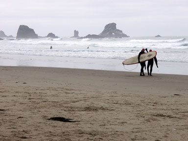
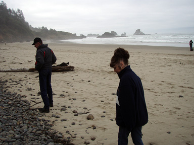
At the north end of town, Indian Beach and Ecola State Park are gateways to the Tillamook Head hiking trail. To reach these secluded and stunning covers, the road winds through lush forest that spills over the spectacular cliffs, all the way to the shoreline. Both beaches encompass beautiful stretches of sand with dramatic cliffs and evergreen trees, and offer the perfect beachcombing combination of rocks and driftwood. Ecola is a popular surfing spot, while both stretches of sand feature a treasure-trove rocks and driftwood for more beachcombing.
|
 |
|
 |
Ecola State Park Surfers Vicki Andersen photo |
|
Beachcombing at Ecola State Park Vicki Andersen photo
|
Tillamook Rock sits in the ocean a mile west of Tillamook Head, base for a lighthouse that has been renovated and converted into a columbarium - a cemetery at sea. Built in 1880 atop the 100 foot tall Rock, it was one of the world’s most exposed lighthouses. A vicious storm in 1896 tossed a rock fragment weighting 135 pounds right through the roof of the light keeper’s quarters.
From landmarks to museums, rivers to forested hillsides, this stretch of the Northern Oregon Coast offers an unfolding pallet of diversions. Captain Gray would be dazed to see the river traffic in his old haunt. John Jacob Astor would be very pleased at the development and commerce triggered by his trading post. Meriwether and William would have been delighted at the variety of activities and amenities Seaside and Cannon Beach now offer the visitor. |
|

